

I live 4 blocks from the Gowanus Canal, New York City’s first designated superfund site and one of the most polluted waterways in the United States. Built in the mid 19th Century, the canal was used for industrial shipping. Manufactured gas plants, paper mills, tanneries and other manufacturing operated along its banks and used the canal as a dumping ground for their wastes.

View of the the Gowanus Canal from the Union Street bridge looking northward.
A thick sludge of contaminants lies on the bottom, containing several dozen hazardous chemical pollutants. Many of these chemicals have also been found in the surrounding soil, including three times the amount of arsenic, ten times the amount of lead, and 320 times the amount of benzathracene deemed safe for residential habitation in New York State. Benzathracene is a carcinogenic chemical compound, meaning there’s more than a good chance it causes cancer.
Want some more staggering statistics on contaminant levels found in the area?
For the last four years, the Gowanus Canal has also been the local focus of my work, which begins with a geographic environmentally compromised area.
The odor wafting from the canal can be putrid, particularly after it rains. The Gowanus Canal is the collection basin for northwest Brooklyn’s combined sewage overflow outfalls.
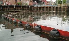
Combined Sewage Overflow in the Gowanus Canal
In New York City, the water from homes, businesses and other structures, which includes human excrement and whatever else people wash down their sinks and toilets, as well as rainwater, and whatever else is on the street, flows into the canal when the water filtration stations are maxed out, occurring during most rainfalls. The northern part of the canal, where the water is most stagnant, is particularly rank, though a pumping station installed several years ago has helped.
Developers are touting Gowanus as Brooklyn’s newest waterfront property, and at steep prices. (Last I checked the asking price for a studio rental at 365 Bond Street was $3,014.) Gowanus is slated for the largest neighborhood rezoning in New York City in 20 years; the population is predicted to double, at least. Meanwhile the Environmental Protection Agency, responsible in part for the clean up of the canal, has warned against developing before remediation. The Department of City Planning is responsible for determining what the future of the neighborhood will look like, including the degree of increased density, types of businesses, infrastructure and public amenities. The Draft Scope of Work that was released several months ago was hugely problematic, containing no real solutions for the increased use of transportation, schools, and water infrastructure that doubling the population would bring. It did spark a flurry of comments by area organizations, however, including Gowanus Canal Conservancy and Gowanus Neighborhood Coalition for Justice, of which I am a member, who both laid out myriads of problems and unaddressed issues.
I don’t think it’s much or a stretch to see the irresponsibility and ignorance of moving a lot of people into an environmentally sensitive, that’s politically correct for toxic, area? (And by ignorant I mean turning a blind eye to an obviously hazardous situation.)

The Gowanus Canal with the surrounding flood zone.
Compounding these issues is the fact that Gowanus is also a Zone A, high risk, flood zone. In relation to mitigating future flooding, zoning can dictate that new construction be built at higher elevations to keep the residents occupying the new buildings safe(r) when another Hurricane Sandy hits. This only means that the lower lying neighbors, who have been in the area much longer, including residents of three NYCHA housing developments, will suffer the consequences much more severely. The water, contaminated, WILL go somewhere.
Once a final plan comes to the table, it requires many folks to sign off including the Mayor, Borough President, and every City Council person.
At the end of the day, given a disaster, or even an individual occurrence, say cancer that eventually metastasizes as a result of exposure to the chemical compounds, who will be responsible? The Department of City Planning? The Mayor? The City Council? The developers? The past polluters? The new buyers? Who is responsible for negligent planning in the face of environmental remediation and climate change?
It seems high time that these questions be brought to the forefront for serious consideration, and to address urban planning in a comprehensive, forward thinking and visionary way.